Rule10 Digital Ltd
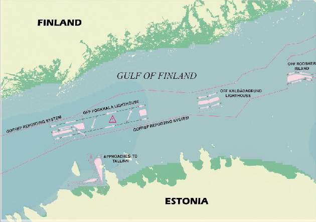
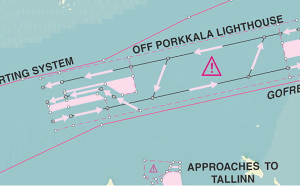
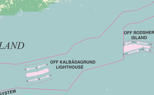
IMO adopted Traffic Schemes
Contains information on all of the IMO adopted routeing measures.
Over 325 routeing schemes at present covering over 13,000 nm of sea.
Rule 10 Digital offers up-to-date Geographic Information System (GIS) primary datasets to the Commercial Marine sector
This growing service for the maritime industry involves researching existing and upcoming regulations and creating usable databases
![]() Supplied in the industry standard “SHP” format
Supplied in the industry standard “SHP” format
![]() Updated regularly as corrections are implemented
Updated regularly as corrections are implemented
![]() Datasets are created from original circulars
Datasets are created from original circulars
Rule10 Digital Ltd

Joint War Committee Listed Areas
Joint war hull committee listed areas
The Joint War Committee comprises underwriting representatives from both the Lloyd’s and IUA company markets

International Navigation Limits
A set of warranties in a hull policy which prohibit the vessel from entering certain waters without payment of additional premium or with a change in conditions.

MARPOL Special areas
Maritime Pollution
Dataset containing the special areas as specified in the six annexes of the
International Convention for the Prevention of Pollution from Ships (MARPOL)

Particularly Sensitive Sea Areas
Particular Sensitive Sea Areas
These areas help protect fragile environments. There are 14 schemes worldwide.

Loadlines Areas
The international loadline zones concern all ships specifying how much cargo each ship can carry safely
Supporting datasets